Copyright ©2023 JBDunn
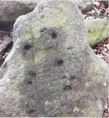
Find out all about the recently discovered ancient petroglyphs which have lain unnoticed, lost to time in a much frequented beauty spot which once claimed the accolade of being the highest point in Leeds.
These mysterious cup marks are not unique to Yorkshire, but are an anomaly in this highly urbanised area of one of Britains most populous cities. Their location is in fact near to King Alfred’s Crag in the leafy North Leeds suburb of Moortown. As its name suggests, this terrain was once a rugged moorland expanse, blanketed in fields of ling – the ancient name for purple flowering heather.
More ornate rock carvings are more commonly found around the heather covered moors overlooking Ilkley, further to the north-west of Leeds, and as far as afield as Scotland and Ireland. Some of these are believed to be as old as the pyramids and can be found as far south in mainland Europe as Spain and Portugal. This has led some academics to the belief that successive migrations of neolithic tribes people are responsible for the intriguing artistic designs which may actually be star maps or charts.
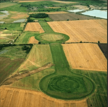
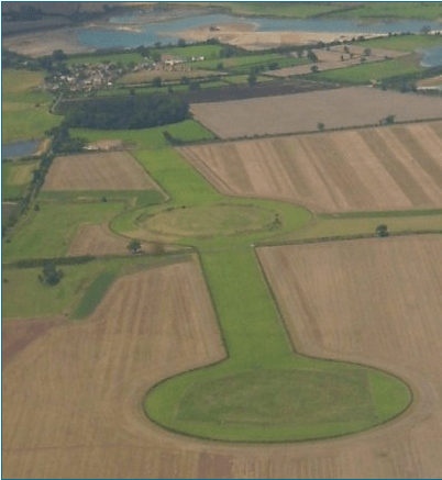
The Thornborough Henges, erroneously referred to a ‘The Stonehenge of the North’, in the Harrogate region of North Yorkshire are believed by some observers to be aligned to the astrological constellation of Orion’s Belt, otherwise known as the Big Dipper. It is speculated the three great pyramids of Giza in Egypt are also aligned to this star formation. Infact, the Pyramids of Giza, Teotihuacan in Mexico, and Xi’an in China, as well as other world heritage sites including structures of the Hopi tribe of North America and the Orkney Henges, another listed ancient monument seemingly aligning with the three stars of the Belt of Orion.
Moving back to the mysterious Moortown-Meanwood stone, other explanations for the existence of these cup marks is that they could represent family groups, or even plans of villages; with each cup hole or in some cases, adjacent ring mark being linked to a long lost hut. Another plausible theory is that the engravings signify the locations of tumuli; burial mounds to pay homage to notable ancestors or the relatives of those folk who etched them onto the nearby boulders.
There does indeed lie a mound nearby further down Stonegate Road in neighbouring Meanwood, which has been interpreted by some scholarly observers to be mass grave dating back to the English Civil War. This was when the Battle of Woodhouse Moor was fought a short distance away, nowadays in the vicinity of the city’s universities, near the suggestively named Rampart Road. At this time, a smaller skirmish broke out on Woodhouse ridge, with a chase by the Royalist Cavalier cavalry giving way and the subsequent slaughter of Cromwellian Roundhead Parliamentarians somewhere close to Meanwood. From this a local legend has sprung up, citing that this conflict caused the local brook, the Meanwood Beck to run red with the blood of the slain soldiers, giving rise to the name Stainbeck. This name however could be attributed to the stream being near Stonegate Road, and the word ‘stain’ simply being an older form of’ stone’, while the road leads to King Lane, itself being originally of stone, possibly Roman, but certainly medieval which led from Kirkstall Abbey to the monastic grange at Chapel Allerton, via Monk Bridge Road at Meanwood.
The aforementioned burial mound does resemble much older tumuli from other places such as those in the Catterstones Woods near Castle Hill in Almondbury, Huddersfield, and therefore could be Bronze Age in origin. It is also entirely possible that a 3000 year old shrine to a departed Celto-Brigantian noble was also later reused, two and half millennia later for the deposition of local victims of The English Civil War, becoming a repurposed gravesite.
See video below:
The tweet below is from over the first Lockdown period of 2020.

Leave a comment